Big Sur right now
Traffic control on Highway 1, south to north
-
PM 39.81
MapTorre Canyon1-way controlled traffic near Torre Canyon Bridge from 0700 hrs to 1900 hrs Monday thru Saturday for about 5 weeks from 10/13/26, delays up to 20 min - Due to post-fire slope work (Caltrans District 5 announcement, via BigSurKate)
-
PM 39.81
MapTorre CanyonFull closure near Torre Canyon, Post Mile 39 to Post Mile 40, Wed Nov 18 and Thu Nov 19, 8 AM to 12 PM and 1 PM to 5 PM (open 12 to 1), weather permitting - wire mesh netting, Timber Fire repairs (via BigSurKate)
-
PM 44.9
MapVentana / Post Ranch / Coast Ridge RoadAlternating one-lane traffic from Ventana Entrance to Nepenthe (North Entrance), through Dec 4 (bridge work - temporary signal)
-
PM 54.1
MapPoint Sur Lighthouse gate1-way controlled traffic at various locations from 7.5 mi north (at Point Sur Lighthouse) to 8.4 mi north of Big Sur 24 hrs a day 7 days a week thru 0700 hrs on 12/31/26 - Due to construction
-
PM 60.05
MapRocky Creek Bridge1-way controlled traffic 15.7 mi south of Monterey (at Rocky Creek Bridge) 24 hrs a day 7 days a week thru 0600 hrs on 11/30/26 - Due to construction
From Caltrans' Highway 1 report and lane closure system; a few come from Caltrans District 5 announcements via Big Sur Kate. PM is the Monterey County post mile on the little markers by the road: 0 at the San Luis Obispo County line, 72 at the Carmel River.
Named slides on Highway 1
Slide names and post miles from Kimball's Big Sur mile marker list (Big Sur Coast Communications, surcoast.com), which Big Sur Kate links; see also her highway maps with slide names. Map positions use Caltrans' own post mile points and are approximate.
Check before you go
Road
- Caltrans Highway 1 conditionsThe text report our status reads every 30 minutes
- Caltrans District 5Project news and planned closures
- CHP incidentsChoose Monterey for live incidents
- Cone Zone report (TAMC)Weekly road work in Monterey County
- Highway maps with slide namesBig Sur Kate's maps, north, central and south
Alerts and emergency
- Ready Monterey CountyCurrent emergency information
- Los Padres NF closure orderMonterey Ranger District closure, through Jan 31, 2027
- Flood and debris flow risk mapBurn-scar risk for Big Sur
- Big Sur CERTCommunity emergency response team
Weather, rain and rivers
- Big Sur forecast (NWS)Point forecast for Big Sur village
- NWS Bay Area / MontereyWarnings and the forecast discussion
- Big Sur River flow (USGS)Gauge near Big Sur
- 24-hour rain totals (CNRFC)California Nevada River Forecast Center
Fire
- Watch DutyReal-time fire information
- ALERTCalifornia camerasWildfire cameras on the ridges
- Big Sur FireBig Sur Volunteer Fire Brigade
- Big Sur South Coast Fire FoundationSouth coast fire patrols
Community
- Big Sur KateThe Highway 1 news people here read first
- Community Association of Big SurCABS
- Los Padres National ForestTrails, campgrounds and forest orders
- Big Sur Chamber of CommerceVisitor information
Most of these come from Big Sur Kate's resource lists. This map shows you where; Kate tells you what it means.
- Pull off only at the mapped stops (designated pullouts, park lots and business lots); some are dirt or gravel shoulders, so read the note
- Shoot Bixby Bridge from Hurricane Point, the big south-side turnout
- Tap any turnout for what's there — vista, beach, trail, or food
- Fuel is limited and expensive in Big Sur and some stations close early; fill up in Carmel or Monterey before you go
- Parking anywhere near Bixby Bridge — banned 900 ft north to 700 ft south, both sides, at all times
- Stopping in the roadway or on the bridge for a photo
- Blocking a turnout entrance while you wait for the light
- Crossing the double yellow for a turnout on the far side — go to the next one
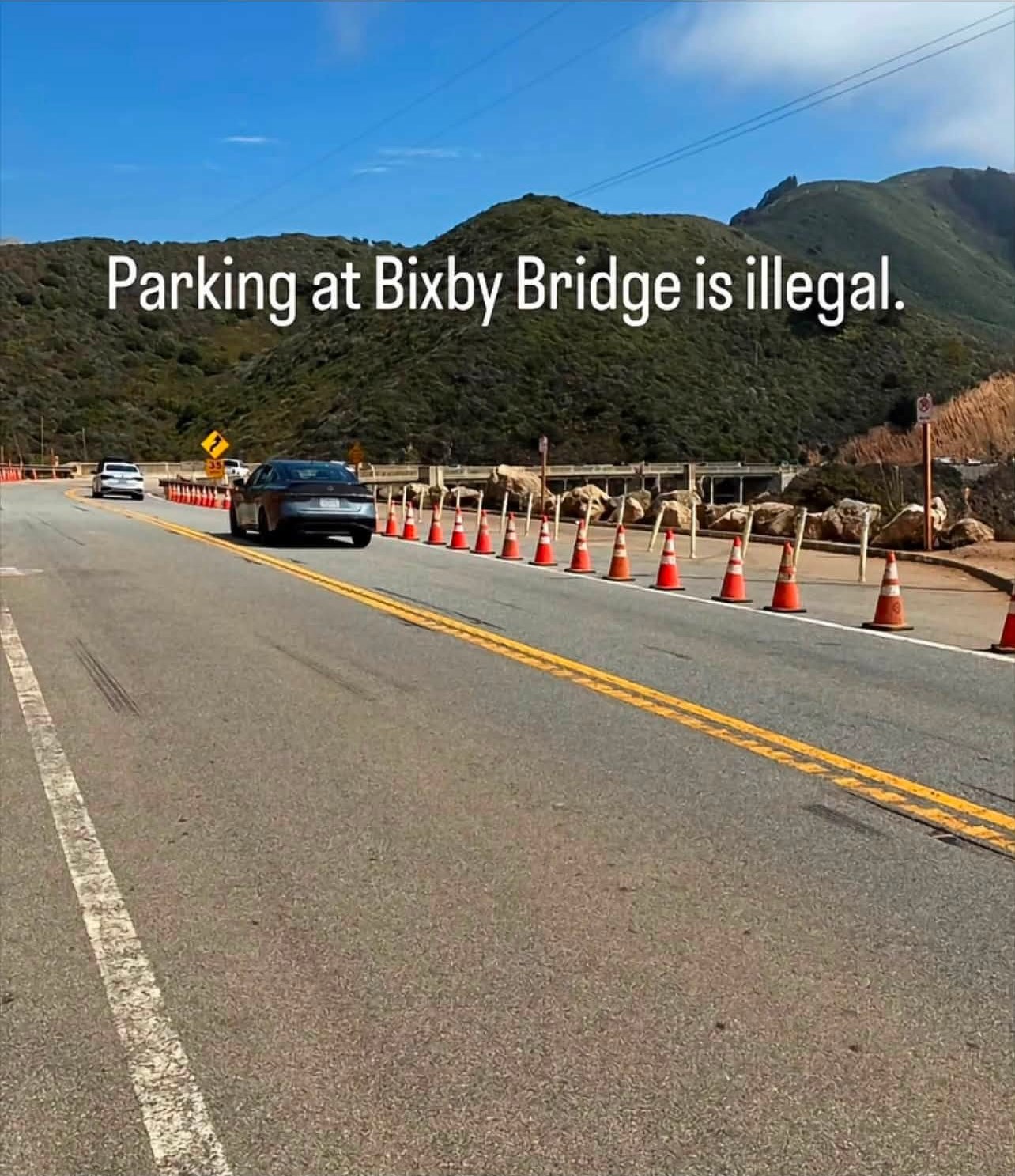
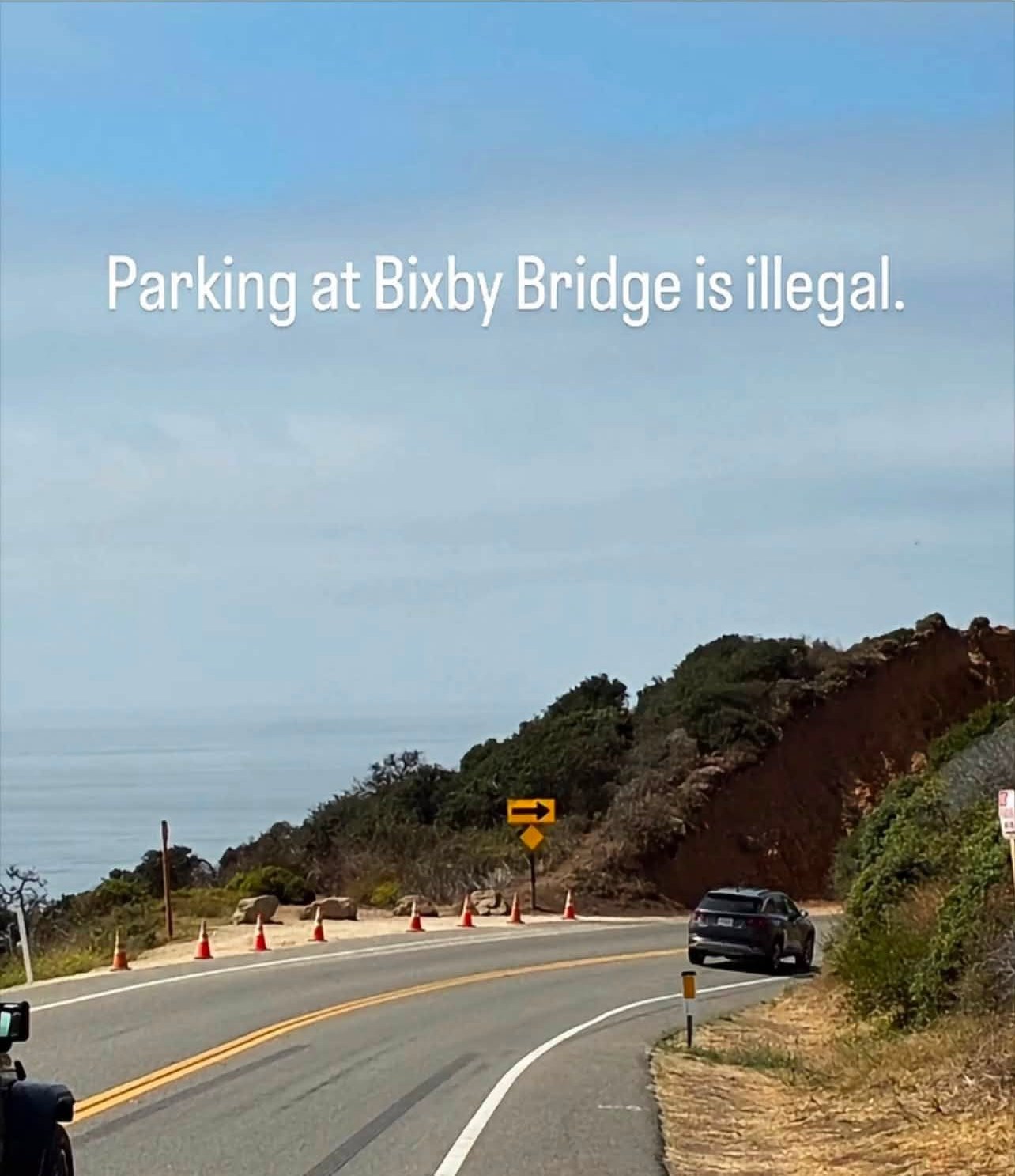
Turnout notes are ours, drive them and tell us what changed. Bixby ban extent: Monterey County Now on the County's 12-month parking ban (signs went up in early August 2026, so about August 2027). Enforcement + camera overlays share the enforcement map's sourced data.
All 67 Highway 1 mile markers, south to north
| PM 0.00 | San Luis Obispo County line |
| PM 2.23 | Salmon Creek |
| PM 6.50 | Gorda Mountain Road |
| PM 6.70 | Grey Slip Slide (slide) |
| PM 7.07 | Villa Creek Bridge |
| PM 8.88 | Mud Creek (slide) |
| PM 10.20 | Gorda |
| PM 11.10 | Los Burros / Willow Creek Road |
| PM 11.50 | Cape San Martin |
| PM 11.66 | Willow Creek Picnic Area |
| PM 13.40 | Jade Cove |
| PM 13.56 | Plaskett Creek Campground |
| PM 13.85 | Sand Dollar Beach |
| PM 14.70 | Pacific Valley Ranger Station |
| PM 17.34 | Wild Cattle Creek Bridge |
| PM 18.46 | Mill Creek Picnic Area |
| PM 18.90 | Nacimiento-Fergusson Road |
| PM 19.01 | Kirk Creek Campground |
| PM 20.76 | Limekiln State Park |
| PM 21.60 | Big (Blue) Slide (slide) |
| PM 22.00 | Paul's Slide (slide) |
| PM 23.00 | Lucia |
| PM 24.00 | Lopez Point |
| PM 26.03 | Gamboa Point |
| PM 28.09 | Big Creek Reserve |
| PM 29.70 | Dolan Point |
| PM 30.10 | Rat Creek (slide) |
| PM 31.17 | Dolan Creek |
| PM 32.20 | John Little State Natural Reserve |
| PM 32.40 | Esalen Institute |
| PM 34.24 | Burns Creek Bridge |
| PM 35.43 | Anderson Canyon Bridge |
| PM 35.80 | Julia Pfeiffer Burns State Park (McWay Falls) |
| PM 36.25 | JPB Slide (slide) |
| PM 37.85 | Partington Cove |
| PM 39.29 | Sycamore Draw / Deer Canyon Slide (slide) |
| PM 39.81 | Torre Canyon |
| PM 40.90 | Coast Gallery |
| PM 41.00 | Old Faithful Slide (slide) |
| PM 42.15 | Fullers Point Overlook |
| PM 43.17 | Deetjen's Big Sur Inn |
| PM 43.50 | Henry Miller Library |
| PM 43.90 | Nepenthe |
| PM 44.90 | Ventana / Post Ranch / Coast Ridge Road |
| PM 45.30 | Big Sur Post Office |
| PM 46.20 | Sycamore Canyon Road (Pfeiffer Beach) |
| PM 46.40 | Big Sur Station (multi-agency) |
| PM 47.20 | Pfeiffer Big Sur State Park |
| PM 47.30 | Fernwood |
| PM 48.30 | Big Sur Library |
| PM 49.00 | Big Sur Health Center |
| PM 49.30 | Big Sur River Inn |
| PM 50.00 | Captain Cooper School |
| PM 51.20 | Andrew Molera State Park / Old Coast Road (south) |
| PM 51.80 | Captain Cooper Slide (slide) |
| PM 54.10 | Point Sur Lighthouse gate |
| PM 56.00 | Little Sur River Bridge |
| PM 58.00 | Hurricane Point |
| PM 59.50 | Bixby Creek Bridge |
| PM 59.60 | Old Coast Road (north) |
| PM 60.05 | Rocky Creek Bridge |
| PM 61.70 | Palo Colorado Road |
| PM 62.97 | Garrapata Creek Bridge |
| PM 64.30 | Granite Canyon Bridge |
| PM 66.00 | Garrapata State Park |
| PM 70.20 | Point Lobos State Natural Reserve |
| PM 72.33 | Carmel River Bridge |
Where to stay
from $254.41 for this weekend (Fri to Sun), taxes and fees included
Rooms are in Carmel and Monterey; none of our stays are in Big Sur itself.
Plan this trip on Hotels & Coast